During the 2007 race I was glued to the internet, following the teams' progress through the Alps. Suddenly my phone rang: it was Aidan Toase: "Hi Tom, it's Aidan -- I'm trying to find a take off but I'm in the cloud and I can't see very far. Can you have a look on Google Earth and see if there's one near me?" Thanks to the live tracking I could find Aidan's exact position as he was on the phone, and was able to tell him that if he walked a few hundred metres north through a forest he'd come to a clear area where he could launch.
 Technology has made an incredible difference to how we paraglide. Through the internet we have access to the latest detailed weather forecasts and up-to-the minute information from the sites. Using Google Earth and online databases like Paragliding Earth and XContest's incredible Skyways Map we have fingertip access to experience that would otherwise take years to acquire. Once in the air live tracking systems like Leonardo Live allow others to follow our progress in real time and are a great safety feature. Pilots who were flying ten years ago may remember analysing every word of the TV news forecast and somehow organising to go flying without using mobile phones. How archaic it seems now.
We'll have a whole host of technology on board to help us in the race. Here's a quick overview.
 The 2009 live tracking, written by Harry Gergits, will be even better this year, with live updates every minute. Red Bull Mobile are supplying us with Sony Ericsson C702 which talk to our Brauniger Compeo+ altivario GPSs via Bluetooth. The Compeo+ collects a minute-by-minute log and packs eight track points in to an SMS which it sends every eight minutes.
Alex will use the live tracking to find me using a satellite car navigation system, and we'll both be watching the other team's movements to observe their route choices.
We'll also use the mobile phone to connect to the internet for the latest weather information and plan our moves on Google Maps and the Skyways Map. We'll make regular diary updates though MMS messages from the phone, which should be able to to text, photos, audio and video.
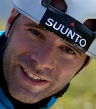
 Suunto are supplying us with their new Suunto Core watch which includes an altimeter, compass and thermometer. All these features will be very useful for navigation in the mountains. For example, you can use the thermometer to measure the environmental lapse rate as you walk up to launch to get an idea of the atmospheric instability on the day.
I'll also be flying with the Leonardo Live tracking system created by Manolis Andreadakis which means that you'll be able to follow my flights in greater detail, it'll act as a backup tracklog in case I have problems with the official tracking devices, and will be further safety device.
 Those of you who know me will know that I have a bit of a fetish for computers and have written quite a lot of software for paragliders. If you're an XC pilot then be sure to check out my XC planner and to analyse your flights with my Google Earth flight analyser (now integrated in to Leonardo). There are also a few geekier projects on my GitHub home page.